Articles Adventure Rally


EAA Vryheid Convention 2018 Adventure Rally

By Rob Jonkers

The EAA convention this year was held at Vryheid, which is situated close to the escarpment and in the heart of the Anglo Boer & Zulu war zones. It was decided to hold an adventure format rally which is becoming a signature EAA event in conjunction with SAPFA, which is a format that EAA’ers enjoy, as a more relaxed fun kind of event mostly involving observation out of the window recognition of ground features and learning about the area being flown over. The Vryheid area is rich in history especially in the war times at the turn of the 20th century. The Vryheid club were new to this type of event and a few members took part, as well as members from other local clubs and of course a number of EAA members.


The Competitors

The theme for this event were following railroads and rivers, and finding a few battlefield sites. The route was mostly towards the north and west, in the mountainous areas of the region, but is also the most scenic area as well, which was one of the objectives for everybody to at least enjoy the local scenery.


Plotting the route
The route started at the local Klipfontein dam just south east of the airfield, and then in an anti-clockwise manner followed the railway line towards the northeast until it disappeared into the mountainside, and then continued to follow the railway northwards until the crossing with the Bivane river, where the teams had to follow the river westwards until they found a prominent farm house complex. From there southwards with no real following features to the Kambule Memorial site, which required recognition of a photo taken at ground level from the air. It was this part of the route that a few of the competitors lost their bearings given the wayward tracks see from the loggers.


The competition map showing the route. From this first battlefield memorial, competitors had to climb a little onto a plateau to find the head waters of the Nsondo river at the top of the Aasvoelkrans gorge, and then fly descending into the gorge where three distinctive waterfalls could be seen, making this the most worthwhile scenic part of the route. At the bottom of the gorge another farmhouse was a waypoint and then to another battlefield memorial of Scheepersnek, and from there to a small farm dam to end off at the Stilwater railway station.

As part of this rally, it was decided that to add some spice as well, to track everybody with loggers to check how accurately they fly to keep within a 1 km corridor, which should have been easy given that one is allowed to fly with GPS. The map and task booklet were provided 20 minutes prior the take-off for everybody to either plan their route with traditional map plotting tools or to program their GPS’s – if they were more at home following the magenta line.

Each route’s leg had turning point photographs to be recognised (either being correct or incorrect), then a few questions had to be answered on ground features or sites that were historic or scenic, mostly cryptic in nature.

 
An example out of the task booklet for one of the turning points….The tracks of some of the competitors – the blue one flown the most accurately and the yellow track of a competitor that got lost

The booklet contained a section of wiki notes that would enable the crews to answer all the questions – with a warning – “Don’t read at your peril….”, and guess what…., most forgot to find the answers in the most obvious place…. Some crews of course were googling for answers on their cell phones – because they can – somewhat inefficient given everything was right in front of them.

There were 14 crews who registered by briefing time, with a broad spectrum of aircraft participating, from a fast Cessna 210 to slow open cockpit Bat Hawks.


Alan Lorimer assisting with getting the task booklets and loggers ready for the competitors

After the briefing, and with 20 minutes prior take-off of handing out papers prepared in sequence by Alan Lorimer, the first competitors took to the skies at 10:15, with the last off at 13.15. The weather was good for flying but the wind had picked up somewhat, which made navigation a little challenging.

With everybody successfully home, it was time for marking the exam papers which was left to Clive King to do, and Rob downloading loggers, and then printing the results.

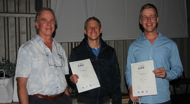
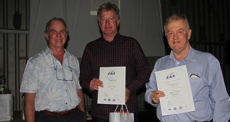


When all was tallied up, two crews tied for first place, Carl Visagie with Navigator Mike Terreblanche in their Ikarus ZU-EOV and Shane Brits with Navigator Karen Stroud in their Jabiru ZU-FEP. Greg Clegg and Keaton Perkins in a Jodel ZU-UEK attained 2nd place, with third place going to Wayne Giles and Mark Clulow in their Bearhawk LSA ZU-IKO. In the spot landing that everybody carried out after the rally, the winner was Mike Ehrich flying a Bantam ZU-ADW.

Thus came to the end of a hopefully enjoyable day for everybody who took part, and given the interest in the event, should bode well for future rallies of this type and also gain an expression of interest in the more formal and timed rallies.


The Overall Results


By Rob Jonkers


This was the 2nd Rand Airport Easter Rally, the event being part of Rand Airport’s Easter Open Day with many activities for the family. It was primarily a Fly-in with the Airport waiving landing fees and reducing fuel prices to attract visitors from out of town.With the success of last year’s event, another Adventure Rally was planned in the style of the EAA Sun & Fun rally events, which of course is all about answering clues and finding Easter Eggs.


The route map – showing the partial route. The Adventure Rally format is a more relaxed fun kind of event mostly involving observation out of the window recognition of ground features and learning about the area being flown over, rather than the high workload of accurate timing.

It is important to have a good crew cooperation on roles and responsibilities, and given the comments heard from the participants after the flight, it seems some cockpits had some hilarious moments.

For this year, for some added spice, the competitors were also tasked to fly within a defined corridor, being 1 km wide like an ANR, just a little wider, with time penalties for excursions outside the corridor

.


Rand Airport Easter Apron with DC4 and competitor aircraft lined up. The route was initially planned out to the west, overhead Nasrec and the Orlando towers, but inadvertently when the route planning was done it was forgotten that the Rand Easter Show would also be on with plenty of SAAF demonstrations, thus with the Notam issued with a 5 nm exclusion zone, had to re-route the start and first two turning points, within 1 day of the event happening, no pressure….


A typical leg task sheet in the booklet. The route was planned on a 1:250 000 map with all turning points marked up – with Martin the invigilator for the day – having to mark up the revised turning points.

The route essentially started out south-west of the silver ball, at the Glenvista Country Club at a small pan at the 12th hole, complementary to the original start point Wemmer Pan, from there further south to the Rand Water Zwartkopjes pumping station which also has an associated Recreation Centre, from there westwards to the Olifantsvlei Nature Reserve with a sharp turn southwards towards Three Rivers and the confluence of the Vaal and Suikerbosrand river.

From the Vaal river the route went up north skirting past the Suikerbosrand nature reserve and then crossing the two airfields Circus and Kliprivier, the photos having been swopped around to confuse everybody. From Kliprivier up to the finish point Romeo Delta past the Heinken Brewery and Panorama Airfield.


Competitors plotting the route. There were 14 crews registered prior to the event, eventually 11 taking part, with some competitors having had difficulty in arriving with low mist from the east.

The weather was mostly good with some rain showers predicted and at one point at around 11 ATC was about to declare IMC with weather moving from the west, which thankfully stayed away.


Ian and Adrienne Saunders Plotting.

After the 8h30 briefing, and with 20 minutes prior take-off of handing out papers, the first competitors took to the skies at 10.15, with the last off at 11.20.


The livetrack24 Google Earth image of two of the interesting tracks. As with some previous rally events, livetracking was done and displayed on the big screen in the briefing room, where two tracks were being followed by spectators with great interest, both tracks doing pretty well, it did appear the Zwartkopjes pumping station proved a little elusive, as well as Kliprivier Airfield with some competitors having zoomed straight past it getting close to the CTR bufferzone before correcting their flight path.

So, what were those gems the competitors struggled with….. the N1 being part of the Cape to Cairo road…., that Boswell Wilkie have / had their home base at Circus Airfield, then of course getting wrong the airfield pictures that showed Kliprivier instead of Circus, and what beer the brewery made…. All of them….

With everybody successfully home, it was time for marking the exam papers which was left to Invigilator Martin Meyer, between the clues and photo recognition, a total of 39 points could be scored. In the interim, I got to download the loggers to mark up the corridor excursions, which counted time penalties.


Third Placed Eugene Schneider and Mark Clulow


Second Placed Shane Brits and Karen Stroud


First Placed Frank and Cally Eckard
When all was tallied up, there was an outright winner with Frank & Cally Eckard, and it was Cally’s excellent quiz answering skills that brought home the prize, with Frank’s flying accuracy even with the flying corridor cut in half for being a Protea, having registered as Xtra-Fun.

Many thanks are extended to Carolle Olivier assisting with the administration of the event, Stuart Coetzee the Rand Airport Manager for all the arrangements .The prize-giving resulted in the top 3 places winning stunning laser cut aircraft and Easter hampers, the winner also winning 100 l of fuel, many thanks to Rand Airport management for the generous prizes on offer.


Rand Airport Management Stuart Coetzee and Carolle Olivier with Rob Jonkers

Thus came to the end of a hopefully enjoyable day for everybody who took part, with a reasonable field size, and hopefully will increase for next year. 


The Overall Results


– By Rob Jonkers

This year’s EAA Sun & Fun flying event was planned similar to the event held in 2015 as a format that EAA’ers enjoyed, as a more relaxed fun kind of event mostly involving observation out of the window recognition of ground features and learning about the area being flown over.

Rob Jonkers giving the briefing in the club-house

Over the last four weeks, a route schedule was hatched with the prime theme of overflying 13 airfields in the Magalies Berg area, why airfields?, well with many of us aviators flying around in this area quite often, it would be a good idea to know about potential forced or precautionary landing places, so a bit of safety advice while having fun in looking for them.

A route proving flight was undertaken to scout the airfields and features of the landscape and figure some nice Easter-egg clues to put in the task sheet.  And so a route emerged with the theme of IFRRR – I follow roads, rivers and railroads.

The result was a route that followed the railway line just north of Brits airfield to the start point and from there picking up the Crocodile River and following it all the way through the mountains west of the airfield, then across the ridge to the middle of the valley to the Hartebeespoortdam, crossing back over the ridge to return to Brits.

The format was in the form of a pre-defined route map that was available prior to the event starting for everybody to either plan their route with traditional map plotting tools or to program their GPS’s – if they were more at home following the magenta line.

Each route’s leg had turning point photographs to be recognised (either being correct or incorrect), around half of them were Google Earth photos and the other half real photos taken courtesy of Marie Reddy, then a few questions had to be answered on ground features or sites that were historic or scenic, mostly cryptic in nature.

The booklet contained a section of wiki notes (compiled courtesy of daughter Jenni)  that would enable the crews to answer all the questions – with a warning – “Don’t read at your peril….”, and guess what…., most forgot to find the answers in the most obvious place….

Some crews of course were googling for answers on their cell phones – because they can – somewhat inefficient given everything was right in front of them.

There were 12 crews who registered by briefing time which was delayed by half an hour as some fog had to lift over some parts of Gauteng, with a broad spectrum of aircraft participating, from Cessna 172 stalwarts to slow open cockpit Bat Hawks.

The Crocodile River – Coming up to Turn Point 1

One of the competitors Thys vd Merwe had to run in his recently overhauled engine and had to do the course at full power settings resulting in a speedy 120 kts giving him the most difficult challenge to carry out the tasks of the course at high speed. We did however give him the prize of fastest competitor home…

There were a number of young budding aviators that were given seats as navigators and thanks extended to the pilots who took on the challenge of accommodating them.

After the briefing, and with 20 minutes prior take-off – of handing out papers, the first competitors took to the skies at 10.20, with the last off at 11.15. The weather was brewing hot and humid after the recent rains with the wind picking up with a midday high of around 25+ kts with lots of turbulence around the Berg, which made some of the newly introduced navigators somewhat green.

With everybody successfully home, it was time for marking the exam papers which was left to the strict invigilators Rene Clulow and Marita Rudolph to record the points. Between the clues and photo recognition, a total of 39 points could be scored.

On returning, the competitors had to carry out a spot landing where landing line judges Hans Schwebel and Ron Stirk were on hand to adjudicate, where Karl Jensen scored a bingo in his C170, Chris Shaw 2nd in a C177, and Sean Russel 3rd in his Sling.

Neil Bowden and Ray Hollins in Sling ZU-OSH

When all was tallied up, the crew of Pierre Dippenaar & Martin Meyer in a C182 ZS-IVC attained first place, Karl Jensen & Mary de Klerk with spotter Irene Mock in a C170 ZU-VAL attained 2nd place, with third place going to Sean and Anthea Cronin in their remarkable open cockpit Bat Hawk ZU-IJI.

This easy to spot farm house along the northern ridge stumped most of the competitors in finding its location

The Sling floating trophy was again in the hands of Pierre Dippenaar (last year’s solo winner) this time with Martin Meyer as his navigator.

Thus came to the end of a hopefully enjoyable day for everybody who took part, and given the large amount of competitors, it should bode well for doing this again in the future, and in the words of SAPFA chairman Frank Eckard, “this is a new way of converting Avgas into Fun”.

Many thanks are extended to Marie Reddy for the assisting with the administration of the event and keeping order in the competitor line-up;  also the prize sponsors, Comet Aviation Supplies, Aviation Direct (the makers of Easy Plan), Neil Bowden’s Air Adventure Tours – who sponsored gift vouchers to the 5 first time young navigators –, African Pilot and SA Flyer  who sponsored magazine subscriptions and for their support to this event.

1st place Pierre Dippenaar & Martin Meyer winning the Sling Floating Trophy
1st 3places, Karl Jensen, Mary de Klerk, Martin Meyer, Anthea Cronin, Pierre Dippenaar, Sean Cronin, Rob Jonkers (organiser)

The Overall Results

Brits Sun & Fun Adventure Rally  12 Nov 2016 – Navigation Task Results
Route Planner – Rob Jonkers
FILE Position Pilot Name Navigator Name COUNTRY Aircraft Registration Aircraft Type Navigation & Tasks (Total = 39) Spot Landing
1 Pierre Dieppenaar Martin Meyer ZS-IVK C182 32
2 Karl Jensen Mary de Klerk ZU-VAL C170 30.5
3 Sean Cronin Anthea Cronin ZU-IJI Bat Hawk 28
4 Louis Jordaan Jordan Jordaan ZU-IES Bat Hawk 27.5
5 Sean Russel Mark Clulow ZU-TAD Sling 27.5
6 Neil Bowden Ray Hollins ZU-OSH Sling 26.5
7 Nick Christodoulou Andre Kluyts ZS-SYA C172 25.5
8 Tristan Brouard Anton Jansen ZU-SNG Sling 21
9 Wayne Giles Brendan Giles ZU-BHP Bear Hawk 17.5
10 Anthony Harris Kevin Marsden ZU-FCA RV7 16
11 Chris Shaw John Shaw ZS-IFY C177 16
12 Thys van der Merwe Kyle Baytopp ZU-AFP C172 13.5
Brits Sun & Fun Adventure Rally 2016 – Landing Results
1 Karl Jensen Mary de Klerk ZU-VAL C170 1
2 Chris Shaw John Shaw ZS-IFY C177 2
3 Sean Russel Mark Clulow ZU-TAD Sling 3
4 Sean Cronin Anthea Cronin ZU-IJI Sling 4
5 Louis Jordaan Jordan Jordaan ZU-IES Bat Hawk 5
6 Thys van der Merwe Kyle Baytopp ZU-AFP C172 6
7 Neil Bowden Ray Hollins ZU-OSH Sling 7
8 Tristan Brouard Anton Jansen ZU-SNG Sling 8
9 Wayne Giles Brendan Giles ZU-BHP Bear Hawk 9
10 Anthony Harris Kevin Marsden ZU-FCA RV7 10
11 Pierre Dieppenaar Martin Meyer ZS-IVK C182 11
12 Nick Christodoulou Andre Kluyts ZS-SYA C172 12


The Booklet

This year’s EAA Sun & Fun flying event was planned somewhat differently from previous years where precision rallies were held, with a view that for EAA members a more fun flying event was needed to be tried out.

This task was left to Rob Jonkers and Martin Meyer to devise a new kind of rally format, a big risk to take in the realm of the tried and tested rally formats. The prime objective was to make it real fun, with easy to follow routing.

Thus over the last four weeks, a route schedule was hatched with a route proving flight undertaken to check that the route would be do-able and interesting to fly. The outcome was a route through the scenic Magalies valley, north up through the platinum belt, then south-eastwards along the crocodile river into game bush country.

The format was in the form of a pre-defined route map that was available prior to the event starting for everybody to either plan their route with traditional map plotting tools or to program their GPS’s.


The Map

Each route’s leg had turning point photographs to be recognised (either being correct or incorrect), then a few questions had to be answered on ground features or sites that were historic or scenic,  mostly cryptic in nature. The booklet contained a section of wiki notes ( compiled courtesy of daughter Jenni)  that would enable the crews to answer all the questions – with a warning – “Don’t read at your peril….”, and guess what…., most forgot to find the answers in the most obvious place….  Some crews of course were googling for answers on their cell phones – because they can – somewhat inefficient given everything was right in front of them.

Initially 21 crews registered, with 14 confirming at briefing time, a few had to withdraw with aircraft serviceability problems, and one unfortunate entry had their aircraft blown upside down at Lanseria on Wednesday. In all for such an event a very good turnout, with a broad spectrum of aircraft participating, from the fast RV10 doing 120 knots, to the slowest a Piper Cub at 55 knots and even an Alouette 2 helicopter taking part – they of course had the best view out the window to do photo recognition.


The Questions

After the briefing, and with 20 minutes prior take-off – of handing out papers, the first competitors took to the skies at 9.30, with the last off at 10.30. The weather was thankfully cool with a few rain showers around, although around 11 am, a rain squall with windy conditions passed by the airfield. Most competitors got around the course without deviations, although some had to skirt around the rainy parts towards the last of turning points.

With everybody successfully home, it was time for marking the exam papers which was left to the strict invigilators Rene Clulow and Marita Rudolph to record the points. Between the clues and photo recognition, a total of 38 points could be scored. When all was tallied up, it ended in a tie of 31 points for first place between Piper Cub pilot Pierre Dippenaar, and the team of Thys vd Merwe & Mary de Klerk, and given the possibility of such an eventuality, the winner had to be chosen from a draw of cards “aces high”. The first draw turned out to be another tie…. of queens…., much to amusement of the watching audience, the second draw then determined the outcome with Pierre winning the top spot.

Thus came to the end of a hopefully enjoyable day for everybody who took part, and given the large amount of competitors, it should bode well for doing this again sometime in the future, and in the words of SAPFA chairman Frank Eckard, “this is a new way of converting Avgas into Fun”. Many thanks are extended to the prize sponsors, Dennis Jankelow Associates, Comav, Shell Aviation, Comet Aviation Supplies for their support to this event.


Results

Breifing
Breifing

Third Place
Third Place
Second and First Place


The Winner
The Winner