Virtual Rally Flying Competitions
SAPFA has introduced virtual rally flying competitions where teams can practice their skills without burning avgas.
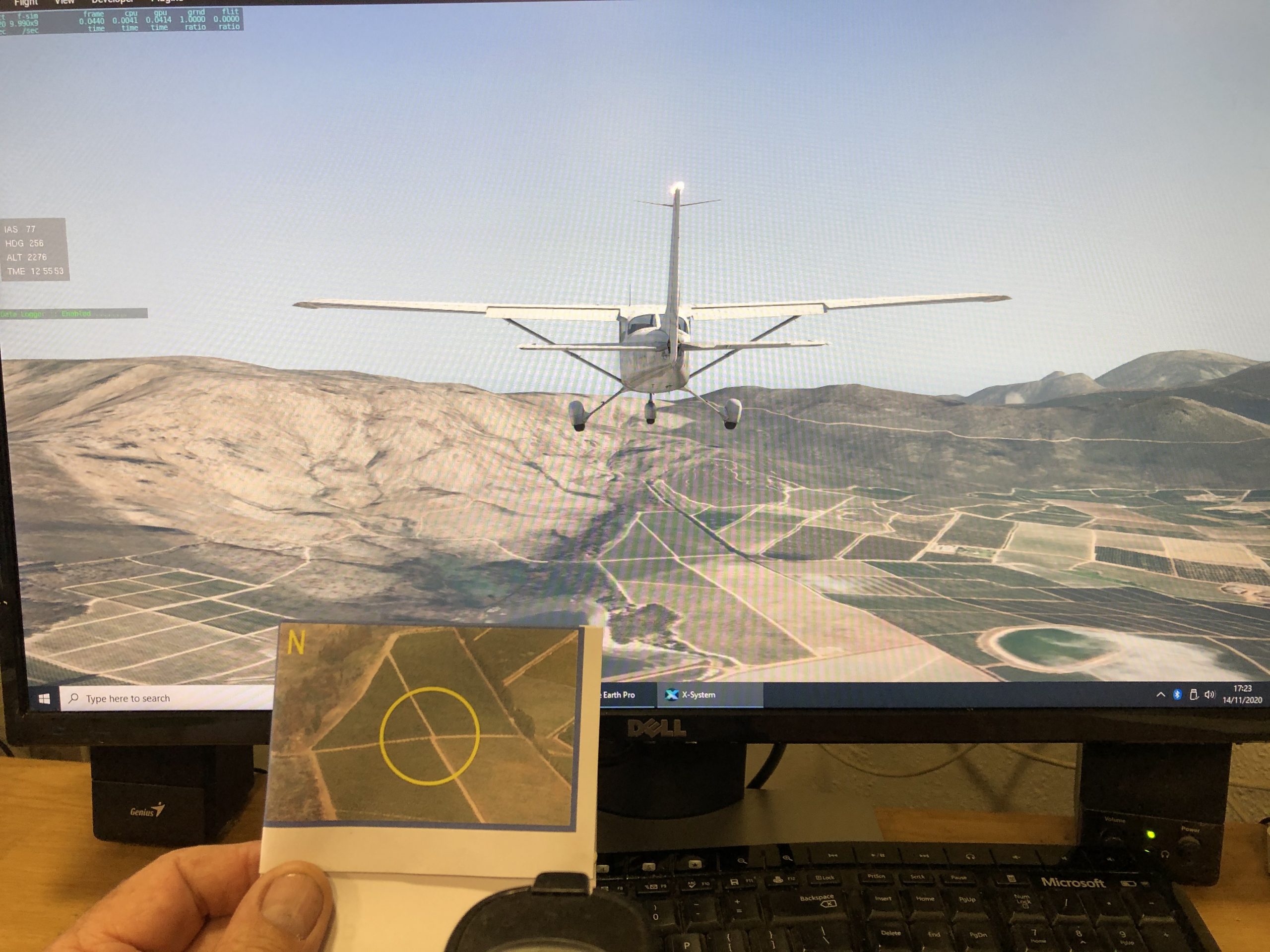
Here you can see us flying a route in the Stellenbosch area, and identifying an enroute photo.
SAPFA has been working with Aeroworx to bring you a suitable platform for flying competitions on your computer.
While we have succeeded with the visual effects, we have not been able to duplicate the comradery and the smell of burnt avgas.
Firstly you will need a computer with a screen and a joystick. The minimum requirements are listed here:
with an app that will check your system.
Next you will need to buy and install your own copy of Xplane.
You can buy this here: https://www.x-plane.com/
Once installed, we need a few add ons.
First you need your own aircraft. This is the cheapest aircraft you will ever own.
Cessna172SPVWR2020.zip (132 MB)
Make a New Folder – \X-Plane 11\Aircraft\My Aircraft and Extract this file to that folder.
When choosing the aircraft to start a flight, go to customize and then at the top right where it says default, click there and choose your callsign livery.
Next you need some on screen instruments.
FlyWithLua.zip
Extract this file to /X-Plane 11/Resources/plugins
This will put among other things Rally_Info.lua into: (/X-Plane 11/Resources/plugins/FlyWithLua/Scripts)
When you restart XP the rally info widget should show up in the top left corner. This will conveniently show, Airspeed, Mag Heading, Altitude and Time.
Now you need a flight logger, so that we can score your flight.
Extract this file to /X-Plane 11/Resources/plugins
This will start logging your flight when you start the program and write the file when you quit Xplane. It will write a log file “TimedProcessing.GAC” to the /X-Plane 11 directory.
And then you need some realistic scenery. Just download and unzip directly to the Custom Scenery folder; above the overlays folder…
This will provide customised Masts
This will provide customised Wind Turbines
This will provide customised scenery for Stellenbosch Airfield, with the Zero landing line.
And now some realistic scenery for the route.
For flying around Brits airfield you need this scenery file:
Brits – zOrtho4XP_-26+027.zip (6.0 GB) (This is large file please email me at frank.eckard@mweb.co.za to request this file)
For the Stellenbosch World Rally Flying Champs, you will need these files:
StellenboschNW – zOrtho4XP_-34+018.zip (4.4 GB) (This is large file please email me at frank.eckard@mweb.co.za to request this file)
StellenboschNE – zOrtho4XP_-34+019.zip (6.1 GB) (This is large file please email me at frank.eckard@mweb.co.za to request this file)
StellenboschSW – zOrtho4XP_-35+018.zip (1.01 GB) (This is large file please email me at frank.eckard@mweb.co.za to request this file)
StellenboschSE – zOrtho4XP_-35+019.zip (3.6 GB) (This is large file please email me at frank.eckard@mweb.co.za to request this file)
Note: These file are numbered by the Bottom Left corner of the latitude longitude square. (Unlike our maps which are named by the top left coordinate)
You can also download your own scenery. (This section is not for pilots, but for computer nerds.)
There is a good video that explains the process, here. https://www.youtube.com/watch?v=OMqI1yLPvF0
And there is another more advanced video here: https://www.youtube.com/watch?v=L3vKEt3MiMM
First you will need to download the Ortho4XP software from here.
Your will need to sign in to X-Plane forums and then you should see the link to:
Windows binary package for v130 (This is for Windows 10 users)
Once downloaded, follow the video for a detailed description of the process.
Just a few notes. We will be using Google Earth Photos for the competition, so do not use the overlays folder, just skip this step.
Use Google earth images G02 at 17 zoom factor. this will then match the images take in Google Earth.
You can email me at frank.eckard@mweb.co.za should you need help.
Have Fun without burning Avgas.