WORLD ANR CHAMPIONSHIP 2019
2019-09-05
2nd FAI World Air Navigation Race Championship Santa Cruz
By Willie Bodenstein. Photos by Barbara Freibose and Jonty Esser
Air navigation racing is a relatively new aviation sport, with this year’s championship being only the second world championships. This year’s competition was organized by the Aeroclube Torres Vedras on behalf of the FAI and in cooperation with the Portuguese General Aviation Commission FPA (Portuguese Aeronautic Federation).The opening ceremony featured the F-16s of the Portuguese Air Force as well as Yaks, Pitts and others.

Santa Cruz Airfield (ICAO: LPSC) is located 60 km North of Lisbon, 15 Km of Torres Vedras City, just a few meters from the beach and village of Santa Cruz.
The World Air Navigation Race (WANR) is a knock-out competition where teams representing their respective countries fly in elimination heats against each other. Precision flying, navigation and landings define this competition. The pilots have to fly along predetermined narrow corridors with irregular shapes at a specific speed. No GPS or other navigation assistance allowed. Teams are only allowed to use a compass, clock and map. All aircraft must enter and exit the corridors at an exactly predetermined time and at the end, must land without engine thrust from downwind in a one-meter box marked on the runway, for no penalties. Crews are penalised for flying outside their corridors and for timing errors. Penalties are also awarded for the landing.

Forty-three crews from seventeen countries entered the competition that started on the 5th of September and concluded on 13the with a gala prize giving dinner held at the Quinta da Almiara Winery ten minutes from Torres Verdas.Five teams from South Africa entered.
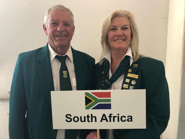
Thys van der Merwe and Mary de Klerk

Mauritz du Plessis and Sandi Goddard
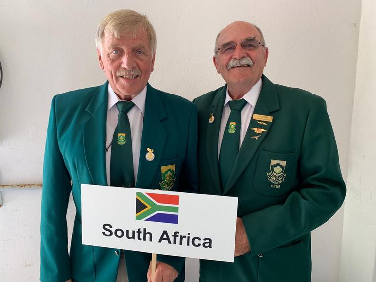
Hans Schwebel and Ron Stirk
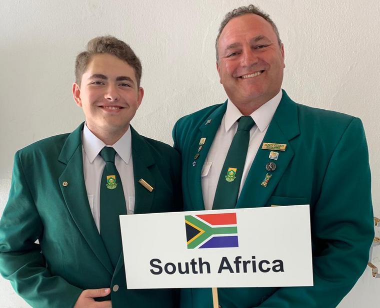
Jonty and Eugene Esser

Anthony and Pamela Russel
The weather throughout most of the championships boasted blustery winds, typical to coastal regions, but was not what the teams from South Africa were used too, as were the maps that they were issued for planning purposes. However, after the practice days, during which approximately 200 training flights were flown in which all competitors had the opportunity to practice navigation routes and precision landings, they were confident that they would do well.

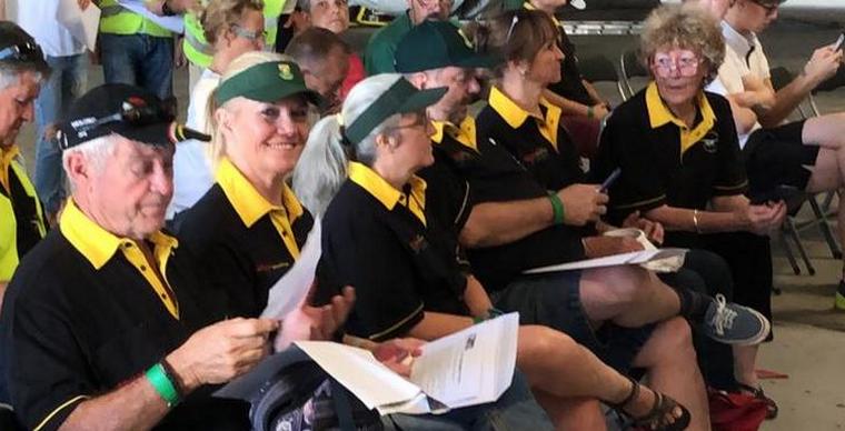
Day one of the championships started with an early morning briefing as did all the other days.
Crews are handed their map with the printed corridor and are only given thirty minutes to plan their flight.
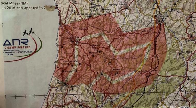
A typical daily task map.
Competitors have to fly along predetermined corridors with irregular shapes at a specific speed (normally 80 knots). The corridors are generated by sophisticated mapping software to ensure they are of equal length.
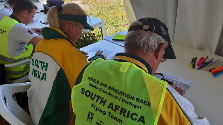


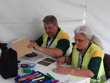
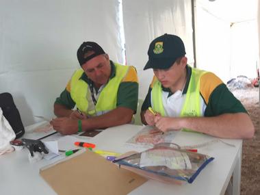
The South Africans hard at work planning their flights.
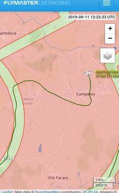
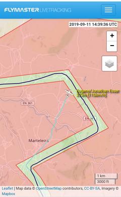
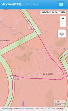
Images taken from the big screen of some of the tracks being flown.
GNSS loggers are used to log the flight track which provides accurate timing to the second. All flights could be tacked live and this brought a new dimension to the sport of air navigation races. In South Africa fellow racers and others were glued to their phones watching the races live.

The final day’s map showing the corridors in the shape of an aircraft that competitors had to fly in.
Instead of international rules, the championship was flown under local rules. Calculating the scores is a rather complicated system. For the navigation race scores only the first three routes were to be used to ensure that all crews had flown the same number of flights. The navigation score was then combined with the landing scores multiplied by ten which resulted in the final overall score.
First overall were B. Radomski and D. Lechowski of Poland followed by Y. Rabassay and M. Esteve of Spain with A. Scramm and A. Fuchs of France in third place.
Thys van der Merwe and Mary de Klerk finished in 12th place with Hans Schwebel and Ron Stirk in 15th place. Mauritz du Plessis and Sandy Goddard finished 17th, while father and son Jonty and sixteen-year-old Eugene Esser 21st and husband and wife Anthony and Pamela Russel 35th.
The landings were won by B. Radomski and D. Lechowski of Poland with M. Osset and D. Benito of Spain in 2nd place with Mauritz du Plessis and Sandy Goddard taking the bronze in 3rd.
Thys and Mary finished in 15th, the Essers 21st, Hans and Ron 24th and the Russels 39th.
Considering that no more than five air navigation races have been flown in South Africa over the last two years, the performance of our teams in stiff competition with teams that regularly flew this type of air racing was fantastic to say the least.
More races are being planned locally for next year and the idea is to promote air navigation races as a spectator sport.
_-_Nationals_Brits_2019/1.png)
_-_Nationals_Brits_2019/2.JPG) The Track shown of Route 3 – an anti-clockwise route
The Track shown of Route 3 – an anti-clockwise route_-_Nationals_Brits_2019/2.jpg)
_-_Nationals_Brits_2019/3.jpg)
_-_Nationals_Brits_2019/4.jpg)
_-_Nationals_Brits_2019/5.jpg)
_-_Nationals_Brits_2019/6.jpg)
_-_Nationals_Brits_2019/7.jpg)
_-_Nationals_Brits_2019/7A.jpg)
_-_Nationals_Brits_2019/8.jpg)
_-_Nationals_Brits_2019/10.jpg)
_-_Nationals_Brits_2019/11.jpg)
_-_Nationals_Brits_2019/12.jpg)
_-_Nationals_Brits_2019/13.png)
_-_Nationals_Brits_2019/14.png)
_-_Nationals_Brits_2019/15.png)
_-_Nationals_Brits_2019/16.png)
_-_Nationals_Brits_2019/17.png)
_-_Nationals_Brits_2019/18.png)
_-_Nationals_Brits_2019/19.jpg)